Re-flights: August 25
Re-flight inspections will be undertaken today with the primary focus being on Zones 1 & 2 (weather permitting).
You may notice the helicopter overhead. It will generally fly at the same height and speed as a rescue chopper, so you may not notice it at all. In some instances, it may need to pause, hover and turn for short periods to ensure we’re collecting clear data.
Inspections were completed by a helicopter mounted with a camera. It flew at around 500 feet above the power lines – the normal height that aircraft, like the Westpac Rescue Helicopter, usually fly.
Electricity supply was not affected during the inspections.
The survey captures images to produce a model of our network. This tells us the condition of our assets so we can identify any potential issues. Using the model, we analyse various scenarios on the network, assess the impact of each scenario and model proposed work programs, such as vegetation work and pole replacement, and determine the effectiveness of the work.
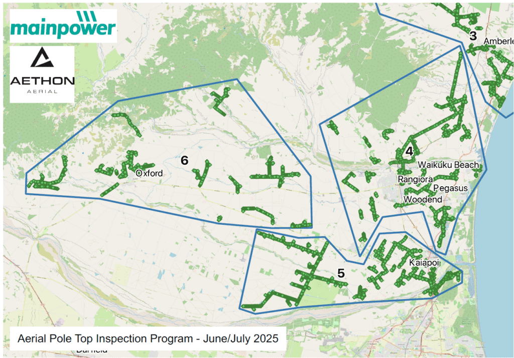
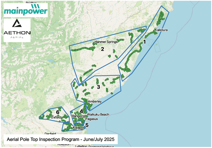
The map below indicates the areas that have been covered.
Customers along the flight paths have been notified, but if you have any questions or concerns, we encourage you to get in touch. Please call our Network Service team on 0800 30 90 80 or use the online form here. You can also email us at nsr@mainpower.co.nz.
Week 1: July 7 – 13 (Completed)
Aerial pole inspections have been completed for Zone 6.
Week 2: July 14 – 20 (Completed)
Aerial pole inspections have been completed for Zone 4.
Week 3: July 21 – 27 (Completed)
Aerial pole inspections have been completed for Zone 1, Zone 2 & Zone 3.
Week 4: July 28 – August 3 (Completed)
Re-flights: August 4 – 17
Re-flight inspections undertaken with the primary focus being on Zone 6 in the Oxford area and then moving to Zone 4 & Zone 5.